


CC_Frances_DD_26_Vega-Valcarce_Pedrafita-Cebreiro_20120823

patrickdanilo
User
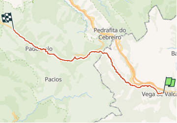

Length
23 km

Max alt
1357 m

Uphill gradient
1032 m
Km-Effort
35 km

Min alt
632 m

Downhill gradient
377 m
Boucle
No
Creation date :
2019-07-11 16:32:54.277
Updated on :
2022-10-18 07:58:55.781
6h45
Difficulty : Very difficult

FREE GPS app for hiking
 SityTrail
IGN / Geographical institutes
SityTrail Plus
The world is yours!
About
Trail Walking of 23 km to be discovered at Castile and León, Unknown, Vega de Valcarce. This trail is proposed by patrickdanilo.
Description
Randonnée Marche de 25 km à découvrir à Vega de Valcarce, León, Castilla y León. Cette randonnée est proposée par patrickdanilo.
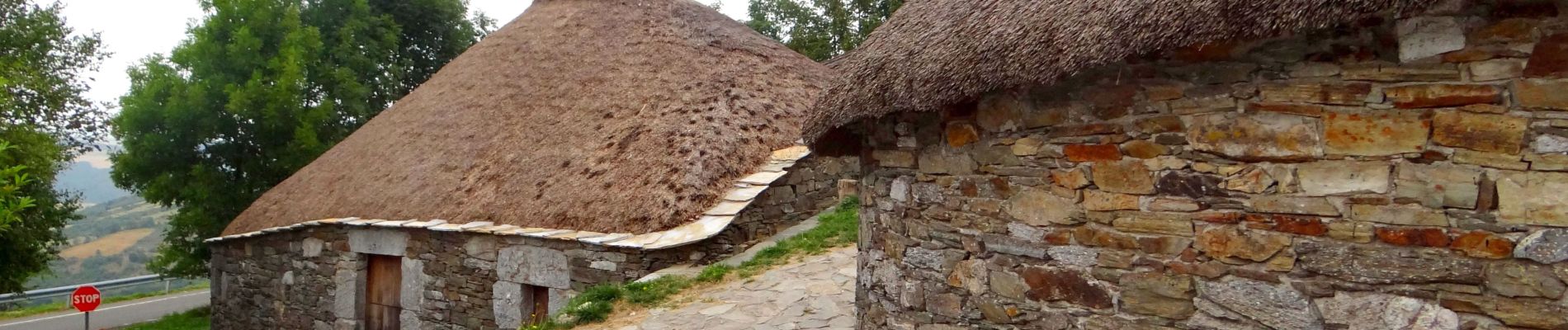
Photos


Positioning
Country:
Spain
Region :
Castile and León
Department/Province :
Unknown
Municipality :
Vega de Valcarce
Location:
Unknown
Start:(Dec)
Start:(UTM)
668251 ; 4725702 (29T) N.
Comments